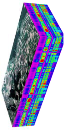
Landsat used to protect wetlands
 Australian authorities are using Landsat data to revolutionise wetland management in Australia and Africa.
In the face of escalating climate change, leveraging natural systems for climate mitigation and adaptation has emerged as a critical strategy.
Known as nature-based climate solutions, these approaches could potentially deliver 37 per cent of the carbon reduction needed to meet the 2030 Paris Agreement targets.
Beyond carbon mitigation, they enhance biodiversity, human well-being, food and water security, and disaster resilience.
Among these solutions, mangroves and freshwater wetlands stand out for their multifaceted benefits.
Mangroves shield coastlines from erosion and storm surges, sequester carbon, and sustain diverse ecosystems. Wetlands mitigate flood risks, filter pollutants, and stabilise local climates through natural heating and cooling mechanisms.
Efficient management of these ecosystems is paramount, and satellite imagery has become an invaluable tool in this endeavour.
Since the 1970s, Landsat satellites, operated by NASA and the United States Geological Survey, have been capturing vital environmental data.
In 2018, Geoscience Australia harnessed this vast archive to launch Digital Earth Australia (DEA), which allows users to track environmental changes over time.
Similarly, Digital Earth Africa, launched in 2019, brings these capabilities to the African continent.
The Wetlands Insight Tool (WIT) and Mangrove Canopy Cover data are pioneering applications of this technology.
Using Landsat data, these tools provide insights into the current state of wetlands and mangroves, showing changes over time and integrating additional data like rainfall and water observations.
Such comprehensive data support informed decision-making for ecosystem protection and restoration.
Digital Earth Australia’s Wetlands Insight Tool (DEA WIT) and Digital Earth Africa’s equivalent (DE Africa WIT) have been instrumental in visualising wetland changes since 1987.
These tools support diverse stakeholders, from government officers to researchers and private industry, in conducting climate impact assessments and monitoring ecological conditions.
“We cannot achieve global biodiversity, climate, or sustainable development goals without addressing wetlands,” says Dr Lisa-Maria Rebelo, Lead Scientist at Digital Earth Africa.
In Queensland, the Department of Environment, Science and Innovation utilises DEA WIT for state planning, wetland conservation, and management.
The tool also aids in meeting Ramsar wetlands commitments and implementing the Great Barrier Reef 2050 Wetlands Strategy.
“The [DEA] WIT information, combined with the existing Queensland wetlands mapping, is a really powerful combination. The outputs are used on a daily basis by a very broad range of stakeholders,” says Mike Ronan, Manager of Wetlands at the department.
In Tanzania, the local government of Zanzibar Island uses Digital Earth Africa's data to manage mangroves, crucial for protecting the community from storm surges and rising sea levels.
Researchers from the State University of Zanzibar, Massoud Hamad and Raya Ahmada, are leveraging this data to conserve and restore mangroves, building community awareness of their importance.
Researchers can Learn more about Landsat here, and learn more about Landsat Products here.


 Print
Print